Processing Data from Satellite Remote Sensing
Course Schedule
Resource Presentations
Case Study Presentations - Let’s pick a winner!
Next Week’s Case Study
Objectives
- Brief introduction to remote sensing
- Obtaining NASA remote sensing data
- MODIS
- MODIS data processing
Active Earth Observing Satellites (EOS) (as of 5/1/2023)
- Total number of operating satellites: 7,560
- United States: 5,184
- China: 628
- Russia: 181
From the Union of Concerned Scientists Satellite Database and Pixalytics Blog
Debris & Satellites in low Earth orbit
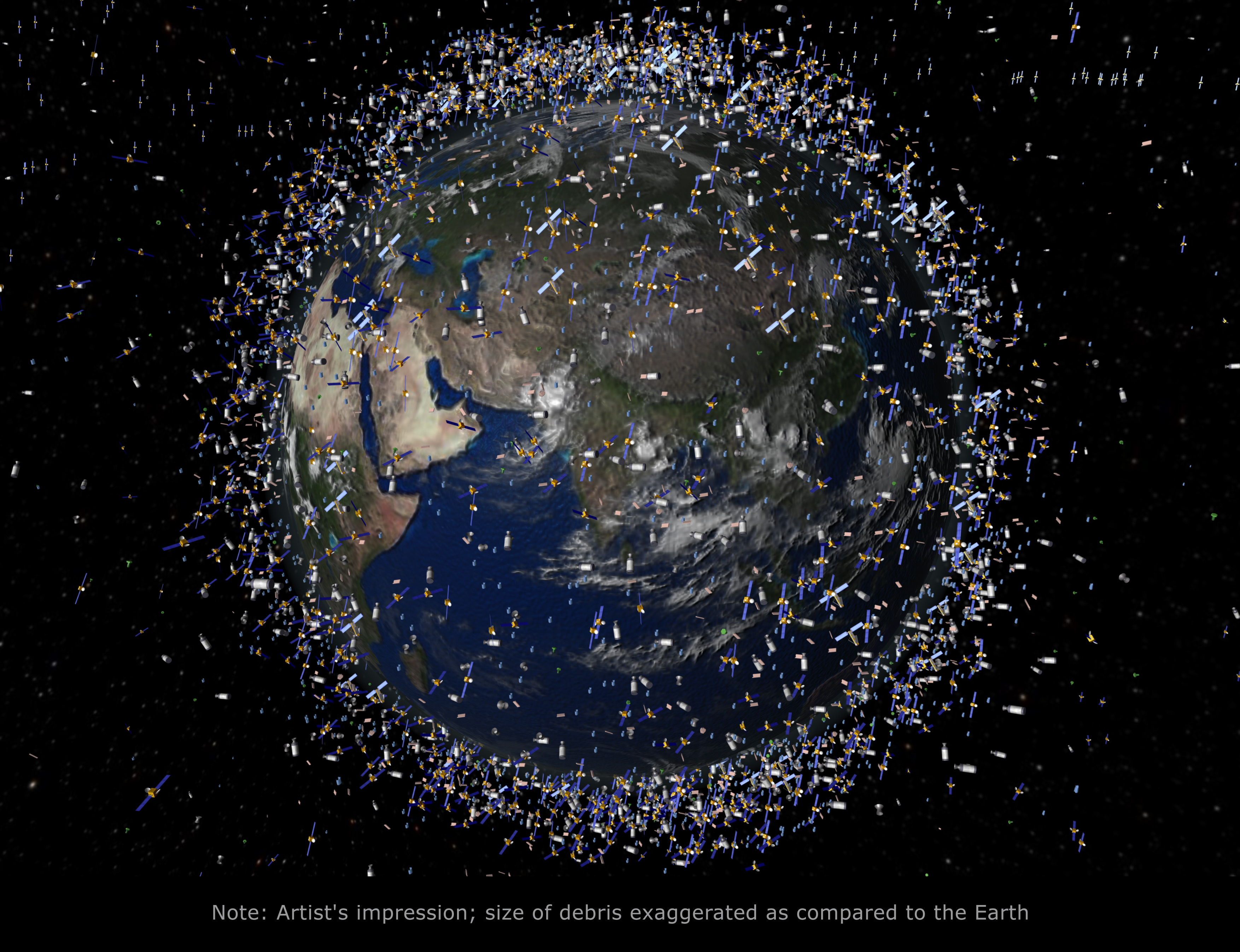
Image courtesy of European Space Agency
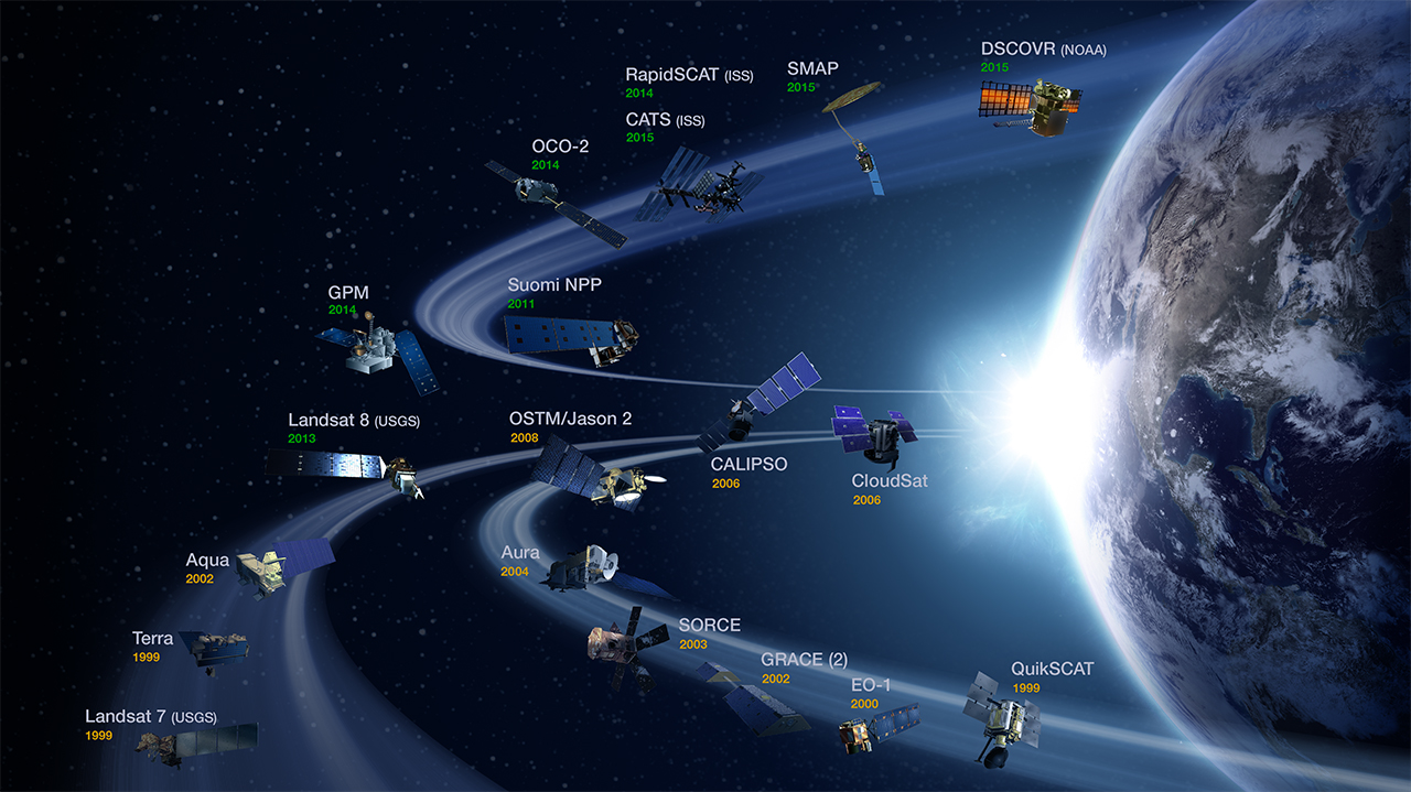
NASA’s Earth Observing System
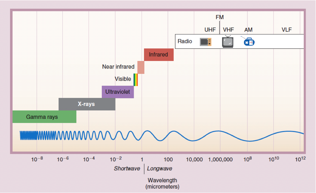
Electromagnetic Radiation
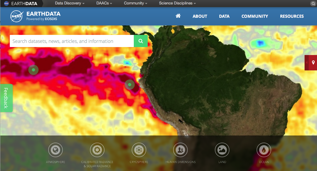
EarthData
Datasets, news, articles, information
EarthData
Datasets, news, articles, information
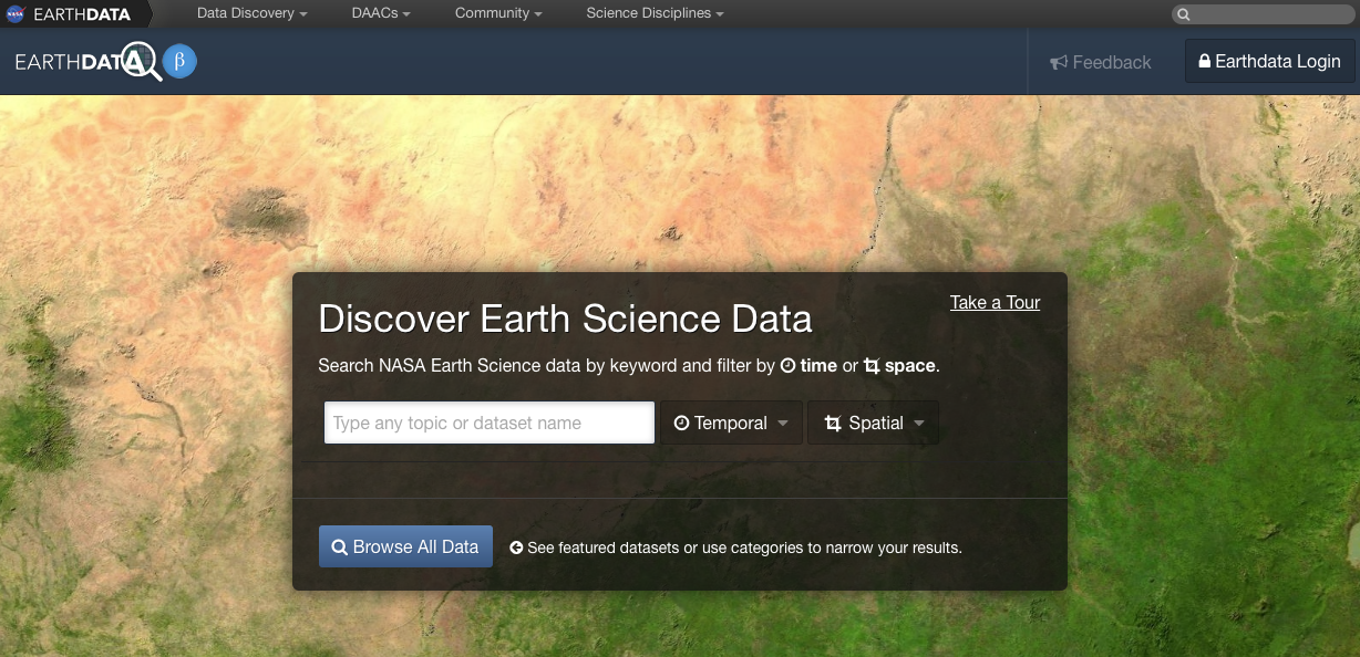
Image Processing in R
Terra Package
library(terra)
# Blue
b2 <- rast('data/rs/LC08_044034_20170614_B2.tif')
# Green
b3 <- rast('data/rs/LC08_044034_20170614_B3.tif')
# Red
b4 <- rast('data/rs/LC08_044034_20170614_B4.tif')
# Near Infrared (NIR)
b5 <- rast('data/rs/LC08_044034_20170614_B5.tif')
b2
## class : SpatRaster
## dimensions : 1245, 1497, 1 (nrow, ncol, nlyr)
## resolution : 30, 30 (x, y)
## extent : 594090, 639000, 4190190, 4227540 (xmin, xmax, ymin, ymax)
## coord. ref. : WGS 84 / UTM zone 10N (EPSG:32610)
## source : LC08_044034_20170614_B2.tif
## name : LC08_044034_20170614_B2
## min value : 0.0748399
## max value : 0.7177562Metadata
## [1] "PROJCRS[\"WGS 84 / UTM zone 10N\",\n BASEGEOGCRS[\"WGS 84\",\n DATUM[\"World Geodetic System 1984\",\n ELLIPSOID[\"WGS 84\",6378137,298.257223563,\n LENGTHUNIT[\"metre\",1]]],\n PRIMEM[\"Greenwich\",0,\n ANGLEUNIT[\"degree\",0.0174532925199433]],\n ID[\"EPSG\",4326]],\n CONVERSION[\"UTM zone 10N\",\n METHOD[\"Transverse Mercator\",\n ID[\"EPSG\",9807]],\n PARAMETER[\"Latitude of natural origin\",0,\n ANGLEUNIT[\"degree\",0.0174532925199433],\n ID[\"EPSG\",8801]],\n PARAMETER[\"Longitude of natural origin\",-123,\n ANGLEUNIT[\"degree\",0.0174532925199433],\n ID[\"EPSG\",8802]],\n PARAMETER[\"Scale factor at natural origin\",0.9996,\n SCALEUNIT[\"unity\",1],\n ID[\"EPSG\",8805]],\n PARAMETER[\"False easting\",500000,\n LENGTHUNIT[\"metre\",1],\n ID[\"EPSG\",8806]],\n PARAMETER[\"False northing\",0,\n LENGTHUNIT[\"metre\",1],\n ID[\"EPSG\",8807]]],\n CS[Cartesian,2],\n AXIS[\"(E)\",east,\n ORDER[1],\n LENGTHUNIT[\"metre\",1]],\n AXIS[\"(N)\",north,\n ORDER[2],\n LENGTHUNIT[\"metre\",1]],\n USAGE[\n SCOPE[\"Engineering survey, topographic mapping.\"],\n AREA[\"Between 126°W and 120°W, northern hemisphere between equator and 84°N, onshore and offshore. Canada - British Columbia (BC); Northwest Territories (NWT); Nunavut; Yukon. United States (USA) - Alaska (AK).\"],\n BBOX[0,-126,84,-120]],\n ID[\"EPSG\",32610]]"## [1] 1863765## [1] 1245 1497 1## [1] 30 30## [1] 1# Do the bands have the same extent, number of rows and columns, projection, resolution, and origin
compareGeom(b2,b3)## [1] TRUECheck the properties of the SpatRast
## class       : SpatRaster
## dimensions  : 1245, 1497, 3  (nrow, ncol, nlyr)
## resolution  : 30, 30  (x, y)
## extent      : 594090, 639000, 4190190, 4227540  (xmin, xmax, ymin, ymax)
## coord. ref. : WGS 84 / UTM zone 10N (EPSG:32610)
## sources     : LC08_044034_20170614_B5.tif
##               LC08_044034_20170614_B4.tif
##               LC08_044034_20170614_B3.tif
## names       : LC08_04403~0170614_B5, LC08_04403~0170614_B4, LC08_04403~0170614_B3
## min values  :          0.0008457669,            0.02084067,            0.04259216
## max values  :          1.0124315023,            0.78617686,            0.69246972
Import multiple bands
##  [1] "data/rs/LC08_044034_20170614_B1.tif"
##  [2] "data/rs/LC08_044034_20170614_B2.tif"
##  [3] "data/rs/LC08_044034_20170614_B3.tif"
##  [4] "data/rs/LC08_044034_20170614_B4.tif"
##  [5] "data/rs/LC08_044034_20170614_B5.tif"
##  [6] "data/rs/LC08_044034_20170614_B6.tif"
##  [7] "data/rs/LC08_044034_20170614_B7.tif"
##  [8] "data/rs/LC08_044034_20170614_B8.tif"
##  [9] "data/rs/LC08_044034_20170614_B9.tif"
## [10] "data/rs/LC08_044034_20170614_B10.tif"
## [11] "data/rs/LC08_044034_20170614_B11.tif"## class : SpatRaster
## dimensions : 1245, 1497, 11 (nrow, ncol, nlyr)
## resolution : 30, 30 (x, y)
## extent : 594090, 639000, 4190190, 4227540 (xmin, xmax, ymin, ymax)
## coord. ref. : WGS 84 / UTM zone 10N (EPSG:32610)
## sources : LC08_044034_20170614_B1.tif
## LC08_044034_20170614_B2.tif
## LC08_044034_20170614_B3.tif
## ... and 8 more source(s)
## names : LC08_~14_B1, LC08_~14_B2, LC08_~14_B3, LC08_~14_B4, LC08_~14_B5, LC08_~14_B6, ...
## min values : 0.09641791, 0.0748399, 0.04259216, 0.02084067, 0.0008457669, -0.007872183, ...
## max values : 0.73462820, 0.7177562, 0.69246972, 0.78617686, 1.0124315023, 1.043204546, ...Blue, Green, Red, NIR
par(mfrow = c(1,2))
plot(b4, main = "Red", col = gray(0:100 / 100))
plot(b5, main = "NIR", col = gray(0:100 / 100))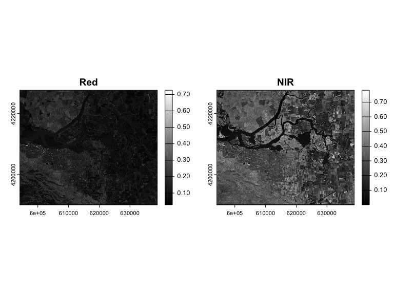
Plotting
landsatRGB <- c(b4, b3, b2)

par(mfrow = c(1,2))
plotRGB(landsatRGB, axes=TRUE, stretch="lin", main="Landsat True Color")

landsatFCC <- c(b5, b4, b3)
plotRGB(landsatFCC, axes=TRUE, stretch="lin", main="Landsat False Color")
Vegetation indices
fndvi <- function(x, y) { # NDVI
    (x - y) / (x + y)
}
ndvi <- lapp(landsat[[c(5,4)]], fun=fndvi) # NIR, Red
plot(ndvi, col=rev(terrain.colors(10)), main="Landsat-NDVI")
More resources
MODIS
Moderate Resolution Imaging Spectroradiometer (MODIS)
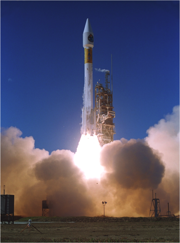
2 Satellites Terra launched in 1999, Aqua in 2002.
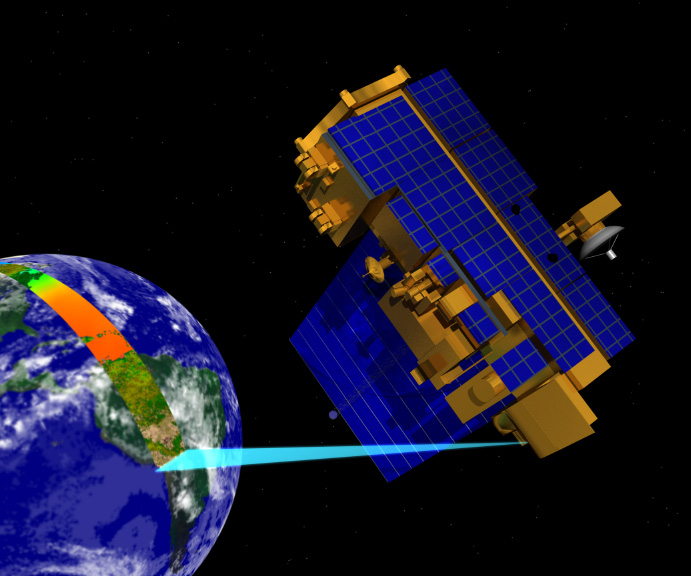
Technical Details: swath
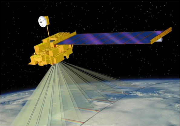
Viewing swath width of 2,330 km
Technical Details: spatial coverage
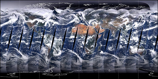
Covers Earth every one to two days
Technical Details: spectral coverage
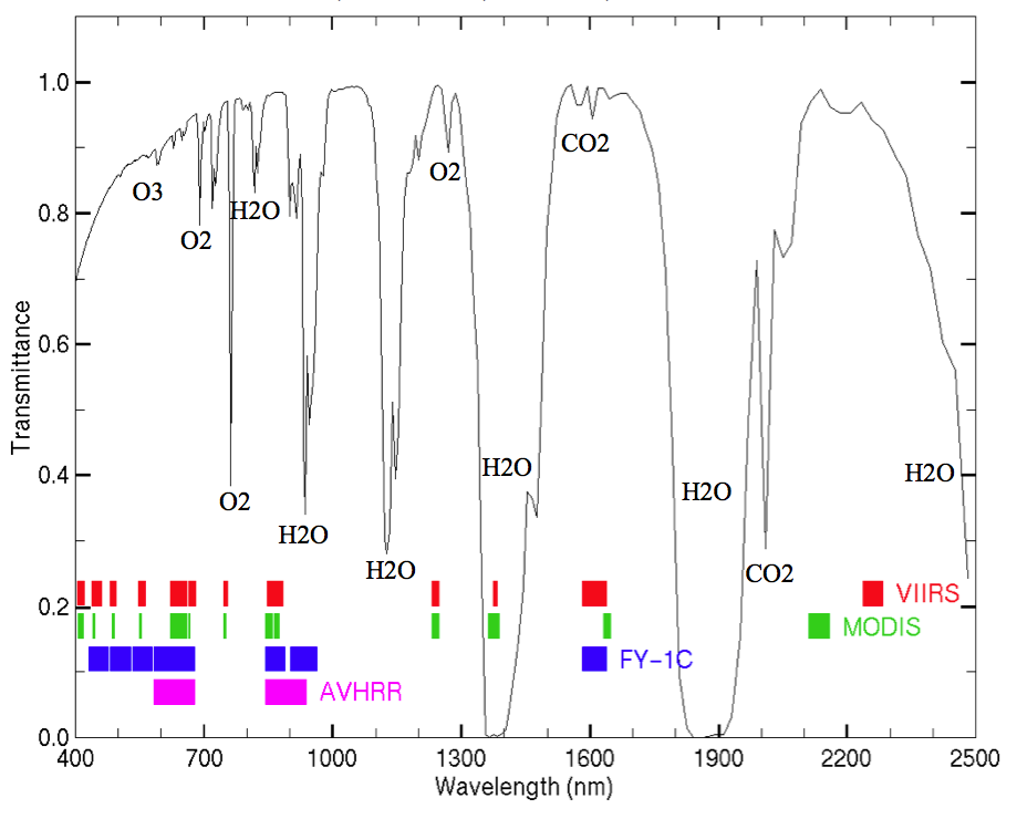
36 spectral bands between 0.405 and 14.385 µm
Technical Details: spatial resolution
3 spatial resolutions – 250m, 500m, and 1,000m
MODIS Data Processing
- Tracking and Data Relay Satellite System in White Sands, New Mexico
- EOS Data and Operations System @ Goddard Space Flight Center in Greenbelt, MD
- MODIS Adaptive Processing System (MODAPS)
- 3 DAACs for distribution
MODIS products (a subset…)
Atmosphere
- Aerosol & Clouds
- Total Precipitable Water
Cryosphere Products
- Snow Cover
- Sea Ice and Ice Surface Temperature
Ocean Products
- Sea Surface Temperature
- Sub-surface Chlorophyll-a Concentration
- Particulate Carbon
- Photosynthetically Available Radiation
Land Products
- Surface Reflectance
- Land Surface Temperature and Emissivity
- Land Cover Products
- Vegetation Index Products (NDVI and EVI)
- Thermal Anomalies - Active Fires
- Photosynthetically Active Radiation (FPAR) / Leaf Area Index (LAI)
- Evapotranspiration
- Primary Productivity
- Vegetation Continuous Fields
- Water Mask
- Burned Area Product
Example product workflow
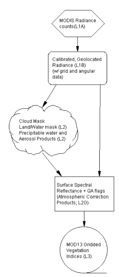
MODIS Products used to generate vegetation indices. From the MOD13 Algorithm Theoretical Basis Document.
Data
Data formats
Most NASA EOS data distributed as HDF files, which are very similar to netCDF.
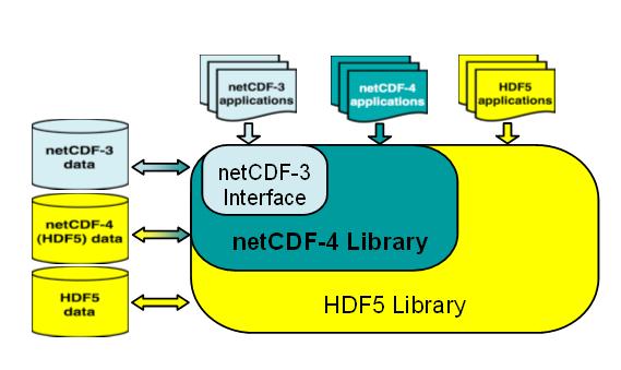
NetCDF / HDF
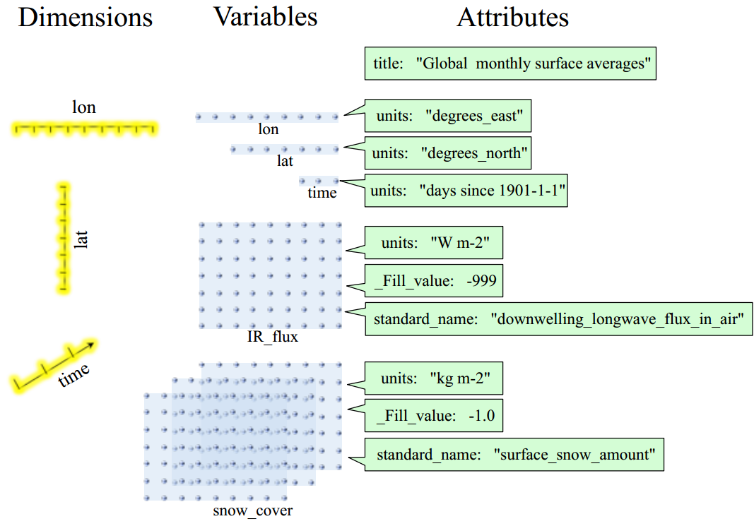
Reading EO Data
terra package functions can read NetCDF/HDF files if
ncdf4 package is installed.
## List of 3
##  $ crs        :List of 20
##   ..$ id                :List of 5
##   .. ..$ id         : num 0
##   .. ..$ group_index: num -1
##   .. ..$ group_id   : int 65536
##   .. ..$ list_index : num 1
##   .. ..$ isdimvar   : logi FALSE
##   .. ..- attr(*, "class")= chr "ncid4"
##   ..$ name              : chr "crs"
##   ..$ ndims             : int 0
##   ..$ natts             : int 10
##   ..$ size              : num 1
##   ..$ dimids            : int NA
##   ..$ prec              : chr "byte"
##   ..$ units             : chr ""
##   ..$ longname          : chr "crs"
##   ..$ group_index       : int 1
##   ..$ chunksizes        : int NA
##   ..$ storage           : int 1
##   ..$ shuffle           : int 0
##   ..$ compression       : logi NA
##   ..$ dims              : list()
##   ..$ unlim             : logi FALSE
##   ..$ make_missing_value: logi FALSE
##   ..$ missval           : logi NA
##   ..$ hasAddOffset      : logi FALSE
##   ..$ hasScaleFact      : logi FALSE
##   ..- attr(*, "class")= chr "ncvar4"
##  $ LST_Day_1km:List of 24
##   ..$ id                :List of 5
##   .. ..$ id         : num 4
##   .. ..$ group_index: num -1
##   .. ..$ group_id   : int 65536
##   .. ..$ list_index : num 2
##   .. ..$ isdimvar   : logi FALSE
##   .. ..- attr(*, "class")= chr "ncid4"
##   ..$ name              : chr "LST_Day_1km"
##   ..$ ndims             : int 3
##   ..$ natts             : int 14
##   ..$ size              : int [1:3] 42 47 811
##   ..$ dimids            : int [1:3] 2 1 0
##   ..$ prec              : chr "int"
##   ..$ units             : chr "K"
##   ..$ longname          : chr "8-day daytime 1km grid Land-surface Temperature"
##   ..$ group_index       : int 1
##   ..$ chunksizes        : int [1:3] 21 24 406
##   ..$ storage           : int 2
##   ..$ shuffle           : int 1
##   ..$ compression       : int 4
##   ..$ dims              : list()
##   ..$ dim               :List of 3
##   .. ..$ :List of 10
##   .. .. ..$ name         : chr "xdim"
##   .. .. ..$ len          : int 42
##   .. .. ..$ unlim        : logi FALSE
##   .. .. ..$ group_index  : int 1
##   .. .. ..$ group_id     : int 65536
##   .. .. ..$ id           : int 2
##   .. .. ..$ dimvarid     :List of 5
##   .. .. .. ..$ id         : int 3
##   .. .. .. ..$ group_index: int 1
##   .. .. .. ..$ group_id   : int 65536
##   .. .. .. ..$ list_index : num -1
##   .. .. .. ..$ isdimvar   : logi TRUE
##   .. .. .. ..- attr(*, "class")= chr "ncid4"
##   .. .. ..$ units        : chr "m"
##   .. .. ..$ vals         : num [1:42(1d)] 1373722 1374649 1375575 1376502 1377429 ...
##   .. .. ..$ create_dimvar: logi TRUE
##   .. .. ..- attr(*, "class")= chr "ncdim4"
##   .. ..$ :List of 10
##   .. .. ..$ name         : chr "ydim"
##   .. .. ..$ len          : int 47
##   .. .. ..$ unlim        : logi FALSE
##   .. .. ..$ group_index  : int 1
##   .. .. ..$ group_id     : int 65536
##   .. .. ..$ id           : int 1
##   .. .. ..$ dimvarid     :List of 5
##   .. .. .. ..$ id         : int 2
##   .. .. .. ..$ group_index: int 1
##   .. .. .. ..$ group_id   : int 65536
##   .. .. .. ..$ list_index : num -1
##   .. .. .. ..$ isdimvar   : logi TRUE
##   .. .. .. ..- attr(*, "class")= chr "ncid4"
##   .. .. ..$ units        : chr "m"
##   .. .. ..$ vals         : num [1:47(1d)] 2362432 2361505 2360578 2359652 2358725 ...
##   .. .. ..$ create_dimvar: logi TRUE
##   .. .. ..- attr(*, "class")= chr "ncdim4"
##   .. ..$ :List of 11
##   .. .. ..$ name         : chr "time"
##   .. .. ..$ len          : int 811
##   .. .. ..$ unlim        : logi FALSE
##   .. .. ..$ group_index  : int 1
##   .. .. ..$ group_id     : int 65536
##   .. .. ..$ id           : int 0
##   .. .. ..$ dimvarid     :List of 5
##   .. .. .. ..$ id         : int 1
##   .. .. .. ..$ group_index: int 1
##   .. .. .. ..$ group_id   : int 65536
##   .. .. .. ..$ list_index : num -1
##   .. .. .. ..$ isdimvar   : logi TRUE
##   .. .. .. ..- attr(*, "class")= chr "ncid4"
##   .. .. ..$ units        : chr "days since 2000-01-01 00:00:00"
##   .. .. ..$ calendar     : chr "julian"
##   .. .. ..$ vals         : int [1:811(1d)] 48 56 64 72 80 88 96 104 112 120 ...
##   .. .. ..$ create_dimvar: logi TRUE
##   .. .. ..- attr(*, "class")= chr "ncdim4"
##   ..$ varsize           : int [1:3] 42 47 811
##   ..$ unlim             : logi FALSE
##   ..$ make_missing_value: logi TRUE
##   ..$ missval           : int 0
##   ..$ hasAddOffset      : logi TRUE
##   ..$ addOffset         : num 0
##   ..$ hasScaleFact      : logi TRUE
##   ..$ scaleFact         : num 0.02
##   ..- attr(*, "class")= chr "ncvar4"
##  $ QC_Day     :List of 22
##   ..$ id                :List of 5
##   .. ..$ id         : num 5
##   .. ..$ group_index: num -1
##   .. ..$ group_id   : int 65536
##   .. ..$ list_index : num 3
##   .. ..$ isdimvar   : logi FALSE
##   .. ..- attr(*, "class")= chr "ncid4"
##   ..$ name              : chr "QC_Day"
##   ..$ ndims             : int 3
##   ..$ natts             : int 7
##   ..$ size              : int [1:3] 42 47 811
##   ..$ dimids            : int [1:3] 2 1 0
##   ..$ prec              : chr "short"
##   ..$ units             : chr ""
##   ..$ longname          : chr "Quality control for daytime LST and emissivity"
##   ..$ group_index       : int 1
##   ..$ chunksizes        : int [1:3] 42 47 811
##   ..$ storage           : int 2
##   ..$ shuffle           : int 1
##   ..$ compression       : int 4
##   ..$ dims              : list()
##   ..$ dim               :List of 3
##   .. ..$ :List of 10
##   .. .. ..$ name         : chr "xdim"
##   .. .. ..$ len          : int 42
##   .. .. ..$ unlim        : logi FALSE
##   .. .. ..$ group_index  : int 1
##   .. .. ..$ group_id     : int 65536
##   .. .. ..$ id           : int 2
##   .. .. ..$ dimvarid     :List of 5
##   .. .. .. ..$ id         : int 3
##   .. .. .. ..$ group_index: int 1
##   .. .. .. ..$ group_id   : int 65536
##   .. .. .. ..$ list_index : num -1
##   .. .. .. ..$ isdimvar   : logi TRUE
##   .. .. .. ..- attr(*, "class")= chr "ncid4"
##   .. .. ..$ units        : chr "m"
##   .. .. ..$ vals         : num [1:42(1d)] 1373722 1374649 1375575 1376502 1377429 ...
##   .. .. ..$ create_dimvar: logi TRUE
##   .. .. ..- attr(*, "class")= chr "ncdim4"
##   .. ..$ :List of 10
##   .. .. ..$ name         : chr "ydim"
##   .. .. ..$ len          : int 47
##   .. .. ..$ unlim        : logi FALSE
##   .. .. ..$ group_index  : int 1
##   .. .. ..$ group_id     : int 65536
##   .. .. ..$ id           : int 1
##   .. .. ..$ dimvarid     :List of 5
##   .. .. .. ..$ id         : int 2
##   .. .. .. ..$ group_index: int 1
##   .. .. .. ..$ group_id   : int 65536
##   .. .. .. ..$ list_index : num -1
##   .. .. .. ..$ isdimvar   : logi TRUE
##   .. .. .. ..- attr(*, "class")= chr "ncid4"
##   .. .. ..$ units        : chr "m"
##   .. .. ..$ vals         : num [1:47(1d)] 2362432 2361505 2360578 2359652 2358725 ...
##   .. .. ..$ create_dimvar: logi TRUE
##   .. .. ..- attr(*, "class")= chr "ncdim4"
##   .. ..$ :List of 11
##   .. .. ..$ name         : chr "time"
##   .. .. ..$ len          : int 811
##   .. .. ..$ unlim        : logi FALSE
##   .. .. ..$ group_index  : int 1
##   .. .. ..$ group_id     : int 65536
##   .. .. ..$ id           : int 0
##   .. .. ..$ dimvarid     :List of 5
##   .. .. .. ..$ id         : int 1
##   .. .. .. ..$ group_index: int 1
##   .. .. .. ..$ group_id   : int 65536
##   .. .. .. ..$ list_index : num -1
##   .. .. .. ..$ isdimvar   : logi TRUE
##   .. .. .. ..- attr(*, "class")= chr "ncid4"
##   .. .. ..$ units        : chr "days since 2000-01-01 00:00:00"
##   .. .. ..$ calendar     : chr "julian"
##   .. .. ..$ vals         : int [1:811(1d)] 48 56 64 72 80 88 96 104 112 120 ...
##   .. .. ..$ create_dimvar: logi TRUE
##   .. .. ..- attr(*, "class")= chr "ncdim4"
##   ..$ varsize           : int [1:3] 42 47 811
##   ..$ unlim             : logi FALSE
##   ..$ make_missing_value: logi TRUE
##   ..$ missval           : int 0
##   ..$ hasAddOffset      : logi FALSE
##   ..$ hasScaleFact      : logi FALSE
##   ..- attr(*, "class")= chr "ncvar4"
Read NetCDF with rast()
## class       : SpatRaster
## dimensions  : 47, 42, 811  (nrow, ncol, nlyr)
## resolution  : 926.6254, 926.6254  (x, y)
## extent      : 1373259, 1412177, 2319343, 2362895  (xmin, xmax, ymin, ymax)
## coord. ref. : +proj=aea +lat_0=23 +lon_0=-96 +lat_1=29.5 +lat_2=45.5 +x_0=0 +y_0=0 +datum=WGS84 +units=m +no_defs
## source      : MOD11A2.006_aid0001.nc:LST_Day_1km
## varname     : LST_Day_1km (8-day daytime 1km grid Land-surface Temperature)
## names       : LST_D~1km_1, LST_D~1km_2, LST_D~1km_3, LST_D~1km_4, LST_D~1km_5, LST_D~1km_6, ...
## unit        :           K,           K,           K,           K,           K,           K, ...
## time (days) : 2000-02-18 to 2017-10-16
Plot Raster Stack
lst[[1:10]] %>% gplot()+
    geom_raster(aes(fill=value))+
    facet_wrap(~variable,nrow=1)+
    coord_equal()+
    theme(axis.text=element_blank())
Collection-Level Naming Conventsions
MODIS/Terra Surface Reflectance 8-Day L3 Global 500m SIN Grid V005
MODIS/Terra- Instrument/SensorSurface Reflectance- Geophysical Parameter8-Day- Temporal ResolutionL3- Processing LevelGlobal- Global or Swath500m- Spatial ResolutionSIN Grid- Gridded or NotV005- Collection Version
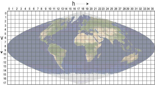
MODIS Gridding system
Filename Conventions
MOD09A1.A2006001.h08v05.005.2006012234657.hdf
MOD09A1- Product Short Name.A2006001- Julian Date of Acquisition (A-YYYYDDD).h08v05- Tile Identifier (horizontalXXverticalYY).005- Collection Version.2006012234567- Julian Date of Production (YYYYDDDHHMMSS).hdf- Data Format (HDF-EOS)
MODIS Temporal Resolution
- Daily
- 8-Day
- 16-Day
- Monthly
- Quarterly
- Yearly
MODIS Spatial Resolution
- Bands 1–2 250-meter
- Bands 3–7 500-meter
- Bands 8–36 1000-meter
MODIS Data
Distributed Active Archive Centers (DAACs)
- Level 1 data: geolocation, cloud mask, and atmosphere products ladsweb.nascom.nasa.gov
- Land products: lpdaac.usgs.gov
- Cryosphere (snow/ice) products: nsidc.org/daac/modis
- Ocean color and sea surface temperature: oceancolor.gsfc.nasa.gov
Accessing data
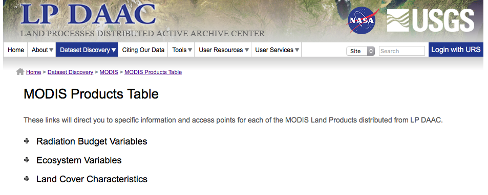
The Land Processes Distributed Active Archive Center has a nice “Data
Discovery” Tool: 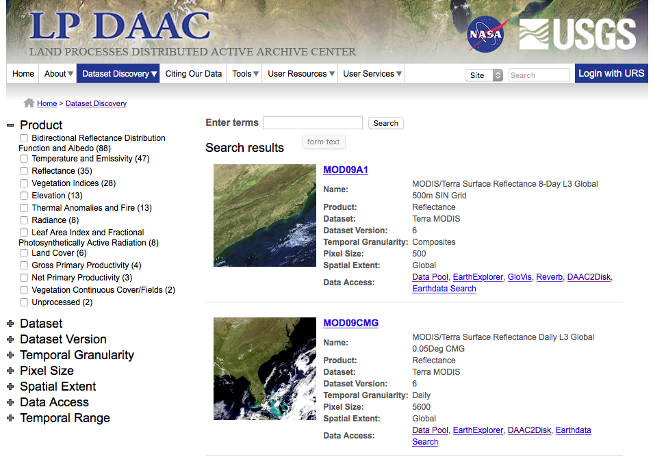
MODIS Products Table
Lists all available MODIS land products
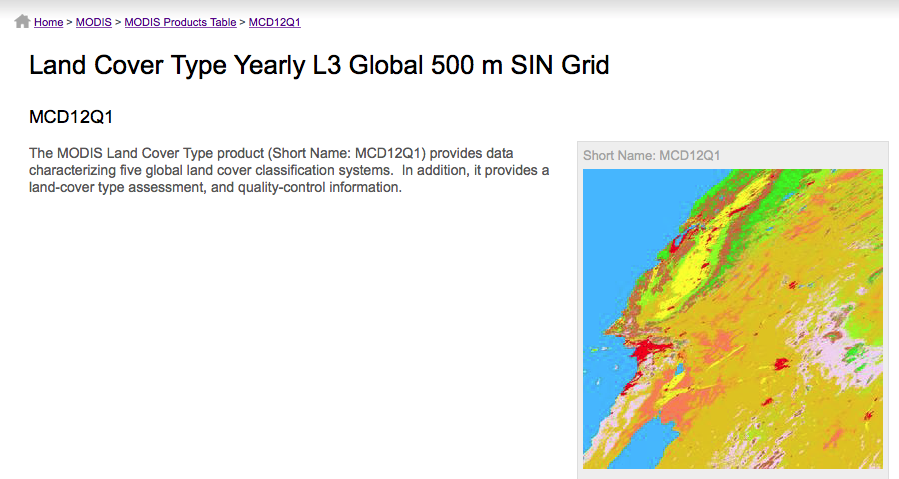
Annual Land Cover Type Description
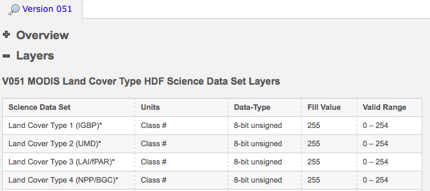
Detailed layer information
Data access links

Downloading: http/ftp access
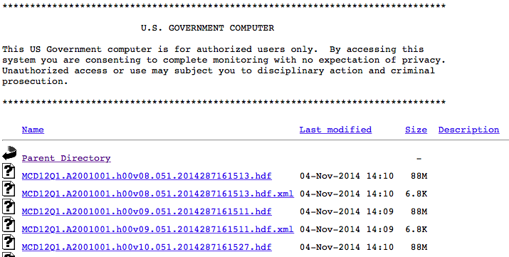
or the LP DAAC2Disk Download Manager which builds a download script.
MODIS Reprojection Tool
Available at lpdaac.usgs.gov/tools/modis_reprojection_tool.
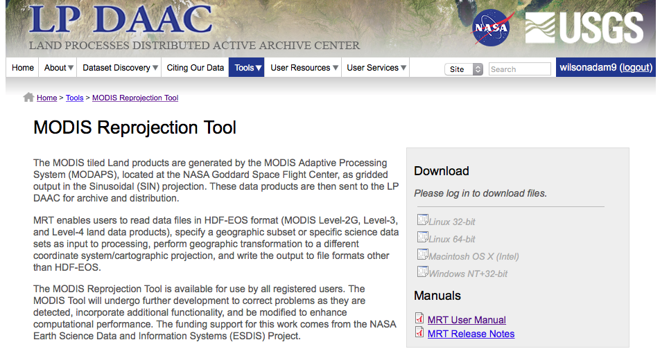
MODIS Reprojection Tool: Subset & Reproject
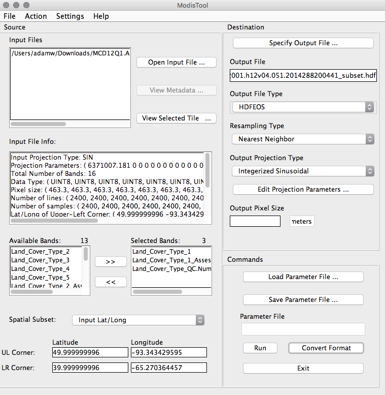
MCD12Q1.A2012001.h12v04.051.2014288200441.hdf
Application for Extracting and Exploring Analysis Ready Samples (AppEEARS)

https://lpdaacsvc.cr.usgs.gov/appeears/
- Provide access to regional subsets
- Merge across tiles
- Download full time series
Data Subset
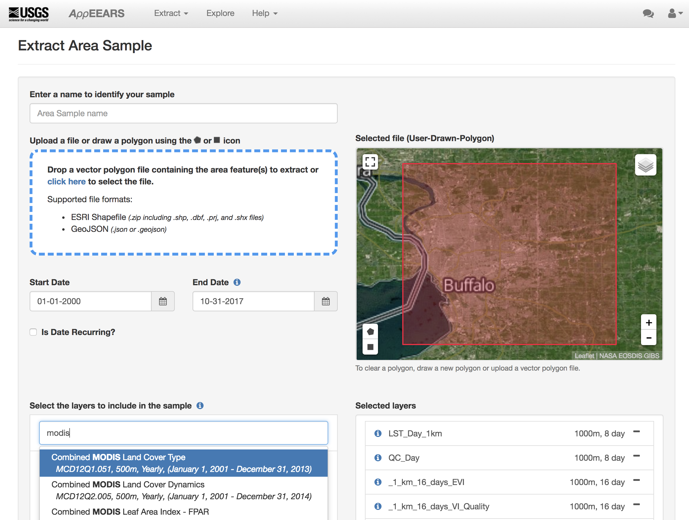
Submit and wait for results…
Case Study
Analysis of Land Use Land Cover and Land Surface Temperature across Buffalo using MODIS timeseries.
Presentation Credits
- Images: NASA
- Some contents from Steve Ackerman
stevea@ssec.wisc.edu, Cooperative Institute for Meteorological Satellite Studies, University of Wisconsin-Madison